Geosurv Resources

Invasive Species

Introduction

Did you know that invasive species cost the Canadian economy billions of dollars annually, threaten our ecosystems, and even impact indigenous ways of life? Combating these unwelcome guests is a complex challenge, but fortunately, advancements in technology like remote sensing are providing powerful new tools in this fight. This blog post explores how aerial imagery, coupled with cutting-edge analysis techniques, is revolutionizing our approach to invasive species management.

A Multifaceted Threat

Invasive species, introduced either intentionally or accidentally, wreak havoc on native ecosystems. They outcompete indigenous plants and animals for resources, disrupt food webs, and alter habitats. The impacts are far-reaching, spanning economic, environmental, and social domains.

<span style="color:#dd641d;">01.</span> <span style="color:#fff;">Economic Impact:</span>

Invasive species decimate agricultural production, damage forests, and hinder recreational activities. In British Columbia alone, crop losses due to invasive species are estimated at over $50 million annually. Nationally, the estimated annual cumulative lost revenue caused by just 16 invasive species is between $13 and $35 billion, with agricultural and forestry industries suffering an estimated $7.5 billion in lost revenue each year. For example, knapweed infestations in rangelands significantly reduce forage quality, impacting livestock production.

<span style="color:#dd641d;">02.</span> <span style="color:#fff;">Environmental Impact:</span>

Invasive species degrade natural habitats, reduce biodiversity, and even contribute to climate change. They can harm forests, coastal areas, and grasslands, and reduce water quality.

<span style="color:#dd641d;">03.</span> <span style="color:#fff;">Social Impact:</span>

Invasive species can threaten indigenous ways of life that are deeply connected to the land and its native species.
Remote Sensing in the fight!

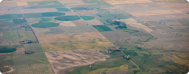
Remote sensing, the process of acquiring information about an object or area from a distance, offers a powerful and efficient way to monitor and manage invasive species. Different types of aerial imagery provide valuable insights:

<span style="color:#dd641d;">01.</span> <span style="color:#fff;">RGB Imagery:</span>

Traditional red, green, and blue imagery can be used to visually identify some larger, more easily distinguishable invasive species. This type of data is readily available and relatively inexpensive.

<span style="color:#dd641d;">02.</span> <span style="color:#fff;">Multispectral Imagery:</span>

This type of imagery captures data across a wider range of the electromagnetic spectrum, including wavelengths beyond what the human eye can see. This allows for more detailed analysis of vegetation health and stress, making it possible to detect subtle changes caused by invasive species before they become widespread.

<span style="color:#dd641d;">03.</span> <span style="color:#fff;">Thermal Imagery:</span>

Thermal imaging detects differences in temperature, which can be useful for identifying invasive species that alter the thermal properties of the environment.

<span style="color:#dd641d;">04.</span> <span style="color:#fff;">GIS Mapping Applications:</span>

Geographic Information Systems (GIS) play a crucial role in integrating and analyzing remote sensing data. GIS allows us to map the distribution of invasive species, track their spread over time, and identify areas at high risk of invasion. This information is essential for developing targeted management strategies.

<span style="color:#dd641d;">05.</span> <span style="color:#fff;">The Evolution of AI in Remote Sensing:</span>

The analysis of aerial imagery has been revolutionized by the development of artificial intelligence (AI) and machine learning models. These models can be trained to automatically detect and classify invasive species with increasing accuracy, even in complex environments. From simple image recognition to sophisticated deep learning algorithms, AI is accelerating the pace of invasive species monitoring and management

A More Effective Fight

Remote sensing and AI are empowering us to:

<span style="color:#dd641d;">01.</span> <span style="color:#fff;">Early Detection:</span>

Identify invasive species infestations early, when they are easier and less costly to control.

<span style="color:#dd641d;">02.</span> <span style="color:#fff;">Targeted Management:</span>

Develop precise management strategies based on the specific location and extent of infestations.

<span style="color:#dd641d;">03.</span> <span style="color:#fff;">Monitoring and Evaluation:</span>

Track the effectiveness of control efforts and adapt management strategies as needed.

<span style="color:#dd641d;">04.</span> <span style="color:#fff;">Predictive Modeling:</span>

Use data on environmental factors and species distribution to predict areas at high risk of invasion.

Conclusion

The fight against invasive species is an ongoing challenge, but remote sensing and AI are providing powerful new weapons. By leveraging these technologies, we can protect our ecosystems, economies, and social well-being from the devastating impacts of invasive species. As technology continues to advance, we can expect even more innovative solutions to emerge in the years to come. What other technologies do you think could play a role in combating invasive species?

Get In Touch

Need Data Driven Solutions?

Contact us today to see how our expertise can help you achieve your goals.

surveying equipment and heavy duty construction equipment